

Book 3 Updates
For those of you with a copy of the first edition you can download the relevant updates by clicking on the First Edition Updates button below.
Some of these updates will have been incorporated into recently printed guide books.
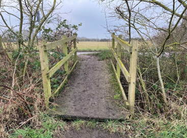
New route over New Bridge over the A14 at Lolworth. Pages 3 and 4.
As part of a huge upgrade to this part of the A14, there is a new bridge over the A14 connecting the village of Lolworth to a new side road that runs parallel to the A14. This enables us to change the route of the GMT which will avoid the tedious and just a little dangerous road walking between Boxworth and the Cambridge Services and shorten to some extent the amount of road walking into Swavesy.
The new route directions have been incorporated into the latest print version of the guidebook and if you have not already walked this section then find the new route directions below. Overall it is a more pleasant and safer route. The new route has now been way marked.
Page 3: line 8 - The new directions now read -
It has a post box, a telephone box that is now Lolworth book exchange and has won awards for being the best kept village. At the centre, keep ahead and walk out of the village. Soon you will see the stream of traffic ahead on the A14.
Page 4 - down to Swavesy information box. The new directions now read -
Follow the pavement, cross the A14 and curve left down to the junction where you turn right along the side road completed in 2020 as part of a massive reconfiguration of this part of the A14. After 600m, turn right along Utton's Drove, pass smelly sewage works on the left and keep on for just under 1km where you turn left along Tippler's Road. At the end, turn right onto the far less peaceful road into Swavesy. The slightly tedious walk to the centre can be mitigated by the purchase of an ice cream at the handy Boxworth End village store and a brief diversion along Ramper Road to view the very discreet Meridian Marker a few yards along the road on the left. Look out for the Baptist Chapels on either side of the road, soon afterwards.
Collect another Meridian Marker by following this route provided by David Gedye
Bottom of page 7: The route is marked blue on the map below. As you join Station Road, having walked up from Brownshill Staunch, don't go right as the way marks suggest but turn left. A short distance down the road is a safe point to cross the road onto the path/cycleway that leads out of Bluntisham. The path leaves the road as it skirts the old railway bridge. Half way round there is an opening that leads onto a public footpath that runs up the edge of the field . Follow the path up the gentle slope. As you proceed up the path the water towers will come into view as does the meridian oak tree planted on the meridian line by a person unknown and date unknown. The oak tree becomes more apparent as you progress up the path. Turn left along the fenced path which takes you past the oak tree and the Meridian Markers erected in 2023. Continue along the path and you come to where you turn right to walk up through Meridian Wood. But before you do, spend a moment telling the time on the human sundial (hope it is a sunny day) installed as a millennium feature in the wood which was planted in December 2000 as the village's millennium project . Enjoy the path through the wood. Arrive at the wood’s roadside entrance where a new path connecting the wood to the village has been put along the adjacent house in Meridian Close. The path brings you onto the Woodend Road leading back into the village . You can cross safely to the path on the other side of the road and proceed downhill into the village. In the village, turn right down the High Street where you will come to the Barograph . Stop a moment and observe the longitude and latitude references on the inside of the roof before turning left into the footpath, re-joining the GMT.
In September 2023 David Gedye invited us to officially open the new Meridian Markers. We were greatly honoured but also felt like frauds because all the hard work had been done by David and his team. The splendid oak tree was planted by the land owner at the time called David Hiam in 1965, or thereabouts.


David Geyde- the human sundial. The authors with David and his team at the official opening
Somersham Quarry Restoration - Creation of the Pocket Park
Page 10: Roy Fabb has provided us with a plan of all the work that has gone into restoring the land north of Somersham after quarrying ended in 2008. The route of the GMT through the old quarries can be found on page 11. The map below shows the full extent of the ambitious restoration. The GMT enters at the blue arrows top and bottom.

Pocket Park - what happens if the lake is flooded!
Pages 10 & 11: when we walked this stretch north of Somersham in early 2024 we discovered that the lake in the Pocket Park had flooded and blocked the path. Roy Fabb told us in June 2025 that the lake is back to its normal level and that the path that skirts the lake to the left is passable if a little muddy.
In the event of you finding that the lake has flooded again, he has provided a very useful map showing an easy way round the flood which handily includes a cafe at a garden centre, en-route. The way out onto Parkhall Road is through a gate on the left some 200 m before the waters edge, to the left of where the picture below of the flooded lake is taken from. Walk ahead and cross bridge onto the road. Turn right and keep on, passing the garden centre, until you come to Short Drove where you turn right. Follow this to where you re-join the trail. Roy Fabb has placed some of our way mark discs with added stickers to help you find your way. Apologies for the hazy nature of the map which is because of interface incompatibilities.


Distant view of the escape gate . Near views of escape gate and bridge onto road.
Willow Farm and a problem path
Page 17: The footpath behind Willow Farm at times continues to cause considerable difficulties for walkers. We walked the path in April 2024 and it was quite clear. And in June 2025 we were informed that the nettles were only ankle high. However, the nettles do grow quickly and it does not take long for the path to become unpleasant to walk along. Sadly, the council can only clear the path twice a year so it is more than likely that there will be nettles. Be prepared, wear long trousers, find yourself a large stout stick, take some secateurs with you and give yourself time to beat your way through. It is just a short section but, if the nettles are high, you will remember it. Please take care climbing the steps up the bank to the road, walking across the bridge on the side of the busy road and scrambling down the bank on the other side where the steps are small and not easy to walk down.
By the way, as you come to the end of Dock Road, where the road turns right (line 3: page 17) be aware that the route is into the yard with the metal barrier, not onto the drive through a wooden gate.
Walking into Boston - a big diversion.
Page 44: Because of the construction of the Boston tidal barrier there is a long diversion through the industrial estate next to the river. According to the barrier web site, the work is 75% complete and the barrier itself is functioning and can be raised in 20 minutes. Of more interest, is the work that is being done on the banks of The Haven to raise the level of the flood defences and consolidate the work on the barrier. We last visited in June 2024 and discovered that the path along the bank of the Haven is blocked off from where it comes out on the road into the centre of town, beside the lock, for about 1 km downstream. This is likely to last for another two years. The diversion through the industrial estate is now clearly signposted with red Footpath 14 signs along the route.
The right-hand picture shows where the diversion begins, where the old and new sea banks come together, and the left-hand picture shows the red Footpath 14 sign where the path comes out onto the road beside the lock.


Last updated July 2025